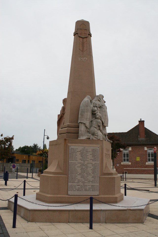
A few hundred yards south east of the two La Chapelle-d’Armentières cemeteries…
…the town war memorial has 179 names inscribed on it of men who died during or as a consequence of the Great War. Which seems to me to be a very large number for what was at the time quite a small place.
The names inscribed on the first panel are of men killed in 1914, 1915 & 1916.
The second panel contains the name of men killed in 1916, 1917 & 1918, along with a number who died in the years following the war. At the bottom of the panel fifteen men killed during the Second World War are also remembered.
Men from the war of 1870 are commemorated on the third panel, along with other nineteenth century military fatalities, and two mid-twentieth century casualties from North African conflicts.
What’s that? What happened to the rain? Oh, believe me, the rain returns, in buckets, next post. As you’ve probably guessed by now, these photos were taken on a nicer day because, I guarantee you, neither of us had any intention of stopping here the first time we passed this way.
Before we move on, let’s take a look at where we’ve been over the previous few posts. This 1917 trench map shows the front lines (British in blue, German in red), and you can see immediately that all the cemeteries we are visiting on this tour run roughly parallel to the lines as we move north. The outskirts of Armentières just encroach in the top left corner. Towards the bottom left of the map, marked in dark green, is Ration Farm Military Cemetery. Moving north we then visited Desplanque Farm Cemetery (light green) and X Farm Cemetery (mauve), followed by Chapelle-d’Armentières Old (light blue) and New (dark blue) Military Cemeteries. La Chapelle-d’Armentières war memorial is marked in red, and our next stop, La Chapelle d’Armentières Communal Cemetery, in orange.


