
Whenever I find myself cruising around the back roads of Flanders I am always on the lookout – of course I am – for evidence of the Great War in the surrounding fields, and bunkers such as this are still the war relics that you are most likely to see.

Although you don’t want to muddle up your World Wars, as there are Second World War bunkers to be seen in these fields too. But keep your eyes peeled, because they go by ever so quickly, whichever war they represent, as you’re speeding past.

I still get a twinge of excitement whenever I spot one, because bunkers are such tangible evidence of the past, and Great War bunkers like this one tend to show evidence of the battering they received when men’s lives depended on them.

If you were to find yourself leaving Ypres (Ieper) by way of the modern N313 heading north east towards St, Julien and the Passchendaele battlefields, in a couple of miles you’d miss the turning and go sailing past, at some speed, the site of this bunker, but turn off on to the lower road at Wieltje, just before you reach Oxford Road Cemetery (shaded in pink) and the memorial to the 50th Northumbrian Division (orange dot), both of which you can then visit on the way, and you’ll find it on your right soon enough. This map is dated 30th June 1917, one month before the Passchendaele offensive would begin, the modern-day field in which you’ll find the bunker marked in green, just behind the German front line trenches, shown in red.

My advice, should you spot one, is to scan the immediate area, because where you find one bunker, you will sometimes find more, this field revealing two,…


…with a third alongside the fence on the right.

I should say, at this point, that these are on private land, so should you ever visit, don’t try and get any closer without permission.

On the left, the modern field overlaid on to one of the first maps available to the British Army early in the war. Note that at the time this map was drawn, pre-war, parts of today’s field were wooded. On the right, the German front lines in April 1917, with trenches snaking through the field and whatever trees still remained,…

…and here a year later, in May 1918, the Germans, following their retreat during the Passchendaele offensive and their advance in the spring of 1918, back in almost exactly the same place as a year previously. And on this map, all three bunkers are marked, beneath the two mauve squares,…

…all of which suggests that these are German bunkers (as opposed to British bunkers built during Third Ypres), confirmed by the fact that none of these bunkers appear in my ‘Observers Book of Bunkers’*, which maintains to catalogue all the remaining British bunkers on the Western Front.
*it’s not really called that.

This detail from the earlier map dated 30th June 1917, showing German positions, also shows this particular bunker as a square within our field, with a trench joining it from the north west,…

…where the entrance to the bunker can be seen here. Note that the map shows no sign of the other two bunkers, although that does not necessarily mean that they were not there at the time. The map is a British map, and the men who studied the aerial photos taken by the R.F.C. reconnaissance pilots and their observers may have been fooled by the earth camouflage that once covered the bunkers, and not spotted them – particularly as we know there were once trees covering part of this landscape. Or at least tree stumps. The trench shown on the map leaving this bunker to the south west before turning 90° to the south east would probably have connected all three bunkers in 1917.
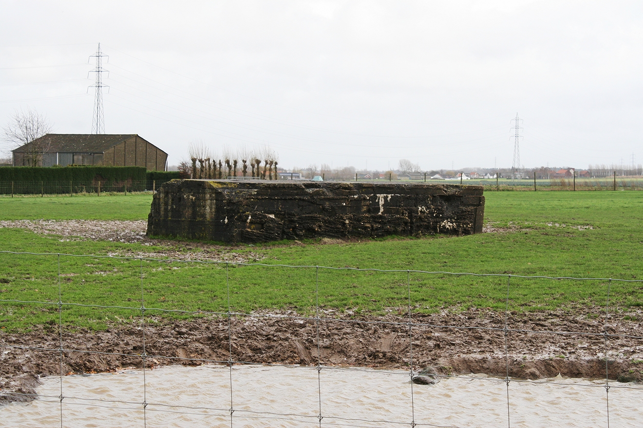
The apparent lack of apertures for machine guns suggests that these bunkers were built to shelter troops,…

…a closer look at this side of this bunker revealing a direct hit from an artillery shell fired from behind the British lines to the south west. Imagine being inside when it exploded. Although better than being outside! Bunkers such as these, built as temporary shelter either from enemy shelling or to protect troops massing for an attack, were not built with comfort in mind. Quite the opposite, in fact, as the men inside would be required to vacate their refuge instantly when ordered, and not be tempted to remain inside in safety.

And if bunkers are your thing, there’s a whole section of this website featuring all the other bunkers we’ve come across over the years. Check the alphabetical Categories list on the right of each page.
There is a German bunker open for the public in Ledegem. Take the Sint-Pieterstraat on your right once you passed Provinciebaan number 170, then go into Industrieweg. On your right, you’ll see the bunker behind a farm. Worth the visit!
One of the places I have yet to visit is the communal cemetery at Roeselare, and from Wervik I guess we would go through Ledegem? Maybe next year – does the bunker have a winter ‘closed’ season, do you know, Filip?